
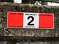
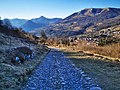
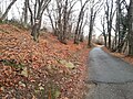
Via dei Monti Lariani
Via dei Monti Lariani has an entry on OpenStreetMap (show).
|

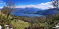
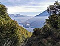
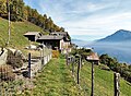
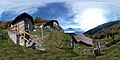
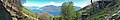
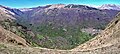
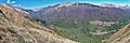
English: Via dei Monti Lariani Lake Como is a hiking trail in Lombardy. It goes along the western side of Lake Como, Italy.
mountain hiking trail along the western bank of Como Lake  .jpg)   .jpg) | |||||
| Upload media | |||||
| Instance of |
| ||||
|---|---|---|---|---|---|
| Location | Lombardy, Italy | ||||
| Has part(s) | |||||
| Start point |
| ||||
| Destination point |
| ||||
| Length |
| ||||
| Mountain range |
| ||||
 | |||||
Section 1
[edit]Main category: Via dei Monti Lariani - sezione 1
-
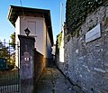
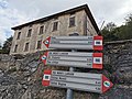
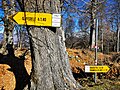
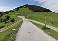
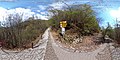
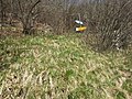
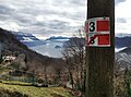
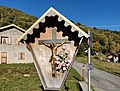
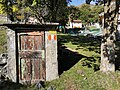
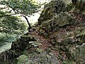
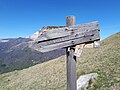
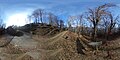
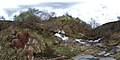
 The very first trail marker of the trail, in Cernobbio
 -
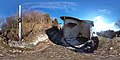
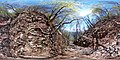
 Photosphere in StimianicoMain category: Stimianico (Cernobbio)
 -
.jpg/120px-Via_Parini_a_Stimianico_(Cernobbio).jpg) The ascent begins in Via Parini in Stimianico
The ascent begins in Via Parini in Stimianico -
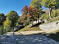
 View of Villa d'Este, from Casnedo
 -
 Photosphere in CasnedoMain category: Casnedo (Cernobbio)
 -
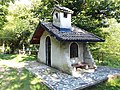
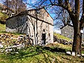
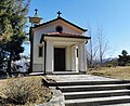
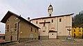
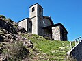
 San Nicola church in Casnedo.Main category: San Nicola (Cernobbio)
 -
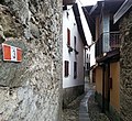
 Trail marker in Casnedo
 -
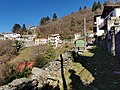
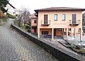
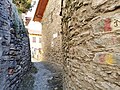
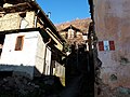
 Alley in Somaino
 -
.jpg/120px-Santa_Maria_delle_Grazie_(Toldino).jpg) Photosphere in ToldinoMain category: Toldino (Cernobbio)
Photosphere in ToldinoMain category: Toldino (Cernobbio) -
.jpg/120px-Chiesa_di_Santa_Maria_delle_Grazie_a_Toldino_(Cernobbio).jpg) Santa Maria delle Grazie church in Toldino.Main category: Santa Maria delle Grazie (Toldino)
Santa Maria delle Grazie church in Toldino.Main category: Santa Maria delle Grazie (Toldino) -
.jpg/120px-Torno_ripreso_da_Rovenna_(Cernobbio).jpg) View of Torno, from Rovenna
View of Torno, from Rovenna -
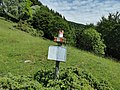
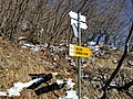
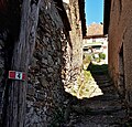
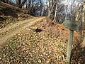
 Fingerpost entering in Rovenna
 -
 Photosphere in RovennaMain category: Rovenna (Cernobbio)
 -
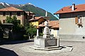
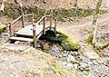
 Drinking fountain in Rovenna
 -
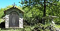
_-_interno.jpg/120px-Cappella_dell%27Ossario_(Rovenna)_-_interno.jpg) Skulls in Cappella dell'Ossario in Rovenna.Main category: Cappella dell'Ossario (Rovenna)
Skulls in Cappella dell'Ossario in Rovenna.Main category: Cappella dell'Ossario (Rovenna) -
.jpg/120px-Facciata_della_Chiesa_di_San_Michele_a_Rovenna_(2).jpg) San Michele church in Rovenna.Main category: San Michele (Cernobbio)
San Michele church in Rovenna.Main category: San Michele (Cernobbio) -
 Leaving Rovenna towards Bisbino
 -
 Fingerpost above Rovenna
 -
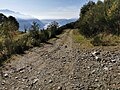
 The track towards Scarone passes aside the road to Bisbino
 -
.jpg/120px-Rovenna_(Cernobbio).jpg) View of Rovenna, from Scarone
View of Rovenna, from Scarone -
 Photosphere in ScaroneMain category: Monti di Scarone (Cernobbio)
 -
 Drinking fountain in Scarone
 -
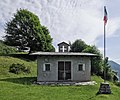
 San Pietro chapel in Scarone.Main category: San Pietro (Cernobbio)
 -
 Photosphere in CulzagaMain category: Culzaga (Cernobbio)
 -
 Approaching Madrona
 -
.jpg/120px-Monti_di_Madrona_(Spherical_panoramics).jpg) Photosphere in MadronaMain category: Monti di Madrona (Cernobbio)
Photosphere in MadronaMain category: Monti di Madrona (Cernobbio) -
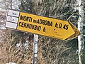
 Guidepost in Madrona
 -
 Hiking along the road to Bisbino in Madrona
 -
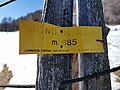
 Map of the hiking trail in Madrona
 -
 Guidepost above Madrona
 -
.jpg/120px-Mulattiera_sopra_Madrona_(Cernobbio).jpg) Above Madrona, the trail separates from the road to Bisbino
Above Madrona, the trail separates from the road to Bisbino -
.jpg/120px-Monti_Albero_del_Cucco_(Spherical_panoramics).jpg) Photosphere in Monti Albero del CuccoMain category: Monti Albero del Cucco (Cernobbio)
Photosphere in Monti Albero del CuccoMain category: Monti Albero del Cucco (Cernobbio) -
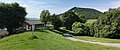
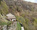
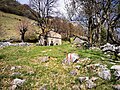
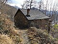
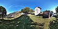
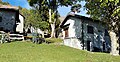
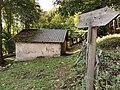
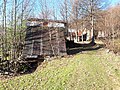
 Huts in Monti Albero del Cucco
 -
.jpg/120px-Bivio_per_Garzegallo_(Cernobbio).jpg) San Carlo little churchMain category: San Carlo (Cernobbio)
San Carlo little churchMain category: San Carlo (Cernobbio) -
 donkeys drinking on the trail
 -
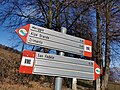
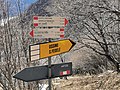
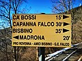 Guidepost at the crossing of the trail with the road to Bisbino, at Alpe Piella
 -
 Above Alpe Piella, the trail takes a not very apparent right turn from the main track, thus heading straight towards Ca' Bossi
 -
 Guidepost at Ca' Bossi
 -
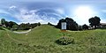
 Photosphere at Colma del Bugone saddleMain category: Colma del Bugone
 -
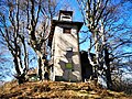
 Rifugio Bugone mountain hutMain category: Rifugio Bugone
 -
 Guidepost at Colma del Bugone saddle
 -
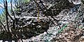
 Photosphere at Colma del Crinco saddle
 -
 Photosphere at Colma di Murelli saddleMain category: Colma Murelli
 -
 Guidepost ato Colma di Murelli
 -
 Rifugio Murelli alpine hutMain category: Rifugio Murelli
 -
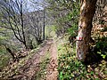
 Forestry road between Rifugio Murelli and ex Rifugio Binate
 -
 Photosphere at Sella del Mortirolo saddleMain category: Sella del Mortirolo
 -
.jpg/120px-Ex_Rifugio_Binate_(foto_panoramica).jpg) Photosphere of former Rifugio Binate alpine hutMain category: Ex Rifugio Binate
Photosphere of former Rifugio Binate alpine hutMain category: Ex Rifugio Binate -
 Guidepost at former Rifugio Binate alpine hut
 -
 Guidepost at Colma di Binate saddleMain category: Colma di Binate
 -
 Photosphere at Colma di Binate saddle, at the junction where the trail leaves the forestry road to point directly towards Colma Crocetta
 -
 Photosphere at Colma Crocetta saddle, where the trail rejoins the ex military roadMain category: Colma Crocetta
 -
.jpg/120px-Panorama_da_Colma_Crocetta_(Schignano).jpg) At Colma Crocetta saddle, Via dei Monti Lariani meets the Sentiero delle Espressioni thematic trailMain category: Sentiero delle Espressioni
At Colma Crocetta saddle, Via dei Monti Lariani meets the Sentiero delle Espressioni thematic trailMain category: Sentiero delle Espressioni -
.jpg/120px-Segnavia_a_Colma_Crocetta_(Schignano).jpg) Guidepost at Colma Crocetta saddle
Guidepost at Colma Crocetta saddle -
 More wooden sculpures of the Sentiero delle Espressioni thematic trail along the road
 -
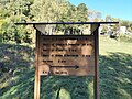
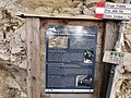 Information board about historic military installations near the trailMain category: Ridotta e osservatorio al Sasso Gordona
 -
.jpg/120px-Fortificazioni_del_Sasso_Gordona_(2).jpg) Guidepost at the junction with the ex military road from Pian delle Alpi, where the trail continues towards Rifugio Prabello alpine hut
Guidepost at the junction with the ex military road from Pian delle Alpi, where the trail continues towards Rifugio Prabello alpine hut -
 Shortly before Rifugio Prabello, the trail leaves the road and turns right into a path downwards towards Pian delle Alpi
 -
 Carved fingerpost for Rifugio PrabelloMain category: Rifugio Prabello
 -
.jpg/120px-Segnavia_Piano_delle_Alpi_(1).jpg) In Piano delle Alpi the trail leaves the woods and comes out in a clearing
In Piano delle Alpi the trail leaves the woods and comes out in a clearing -
 Photosphere at Piano delle Alpi, where the trail turns right on the roadMain category: Piano delle Alpi
 -
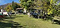
 Detail of a table and barbecue in the pic-nic site at Piano delle Alpi
 -
 After the pic-nic site, the trail leaves the road and turns left into a track towards Ermogna
 -
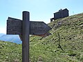
 Guidepost above Piano delle Alpi. The main trail continues straight towards Cascina Carolza. Turn left for an excursion to Erbonne.
 -
_sullo_sfondo_del_Pizzo_della_Croce.jpg/120px-Bolla_di_Ermogna_(Cerano_d%27Intelvi)_sullo_sfondo_del_Pizzo_della_Croce.jpg) The track passes to the right of the Bolla di Ermogna frozen pond
The track passes to the right of the Bolla di Ermogna frozen pond -
 The track flanks the building of Cascina Carolza farm
 -
 Instead of continuing towards Casasco village, the trail takes a left turn in the path towards Rifugio Giuseppe e Bruno restaurant
 -
 Photosphere of a viewpoint over Valle Intelvi valley, fitted with a giant benchMain category: Big bench (Centro Valle Intelvi)
 -
 Guidepost where the trails turns left onto the road to Rifugio Giuseppe e Bruno restaurant
 -
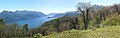
 View of Como Lake from locality 3 Crus
 -
 Three crosses aside the road, whence the name of the locality 3 Crus (italian for "3 Crosses")
 -
 The road is followed to its very end at Capanna Bruno
 -
.jpg/120px-Rifugio_Giuseppe_e_Bruno_(3).jpg) Restaurant (former alpine hut) Capanna BrunoMain category: Capanna Bruno
Restaurant (former alpine hut) Capanna BrunoMain category: Capanna Bruno -
.jpg/120px-Capanna_Bruno_(1).jpg) Guidepost at Capanna Bruno. The trail continues towards Orimento either passing north of Pizzo della Croce peak (walking time 0ː45)...
Guidepost at Capanna Bruno. The trail continues towards Orimento either passing north of Pizzo della Croce peak (walking time 0ː45)... -
.jpg/120px-Capanna_Bruno_(2).jpg) ... or passing south of Pizzo della Croce (walking time 1ː30).
... or passing south of Pizzo della Croce (walking time 1ː30). -
 Photosphere of the fantastic view from the summit of Pizzo della Croce. The detour via the summit is optionalMain gallery: Pizzo della Croce - Monte Crocione..
 -
.jpg/120px-Orimento_(spherical_panoramic).jpg) Photosphere of Orimento saddleMain category: Bocchetta d'Orimento
Photosphere of Orimento saddleMain category: Bocchetta d'Orimento -
.jpg/120px-Segnavia_per_vetta_Monte_Generoso_(2_di_2).jpg) Guidepost in Orimento, at the junction with the path passing south of Pizzo della Croce
Guidepost in Orimento, at the junction with the path passing south of Pizzo della Croce -
.jpg/120px-Segnavia_per_vetta_Monte_Generoso_(1_di_2).jpg) The excursion to Vetta Monte Generoso (fantastic viewpoint) is optionalMain gallery: Monte Generoso.
The excursion to Vetta Monte Generoso (fantastic viewpoint) is optionalMain gallery: Monte Generoso. -
.jpg/120px-Orimento_(Centro_Valle_Intelvi).jpg) Photosphere of the settlement of OrimentoMain category: Orimento
Photosphere of the settlement of OrimentoMain category: Orimento -
 Restaurant Baita d'Orimento
 -
 Guidepost in Orimento, at the junction with the path passing north of Pizzo della Croce. From here, the trail follows the road until the first hairpin bend.
 -
 Guidepost at the first hairpin bend after Orimentoː the trail follows a path which short cuts the second hairpin bend
 -
 Guidepost at the third hairpin bend after Orimentoː the trail leaves the road and heads towards Monte Cristè
 -
 Pond at Monte Cristè
 -
.jpg/120px-Segnavia_a_Monte_Cristè_(1_di_2).jpg) Guidepost at Monte Cristè
Guidepost at Monte Cristè -
 Below Monte Cristè, the path joins the road towards Alpe Grande
 -

-
 Coming from Alpe Grande, a guidposts indicates that here the route leaves the road
 -
.jpg/120px-Bolle_a_Alpe_Grande_(Centro_Valle_Intelvi).jpg) The frozen ponds over Alpe Grande
The frozen ponds over Alpe Grande -
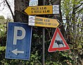
 The road junction at Alpe Grande. The route turns left and continues along the road towards San Fedele (leaving the parking and picnic site to the right)
 -
.jpg/120px-Area_pic-nic_Cristè_(Alpe_Grande).jpg) Detail of the public picnic site at Alpe Grande
Detail of the public picnic site at Alpe Grande -
 in locality Meriggio, the route leaves the road and turns lefto into a track
 -
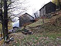
 Rural buildings in Meriggio
 -
 The track turns into a path in the meadow
 -
 A guidepost tells to continue along the path through the meadow
 -
 A guidepost points to the path, where the path rejoins the road
 -
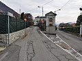
 The route continues along the road until its end at the bus depot
 -
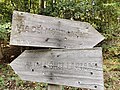
 The bus depot in San Fedele, here finishes section 1 of the Via dei Monti Lariani
 -
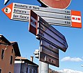
.jpg/120px-Segnavia_a_San_Fedele_Intelvi_(2_di_2).jpg) The first guidepost of section 1, starting from San Fedele.
The first guidepost of section 1, starting from San Fedele. -
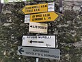
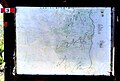
 At the bus depot, this schematic maps shows the Via dei Monti Lariani trail, with details of sections 1 and 2


.jpg)


.jpg)
.jpg)
.jpg)


_-_interno.jpg)
.jpg)


.jpg)


.jpg)


.jpg)
.jpg)

.jpg)


.jpg)


.jpg)
.jpg)


.jpg)


.jpg)


_sullo_sfondo_del_Pizzo_della_Croce.jpg)


.jpg)
.jpg)
.jpg)

.jpg)
.jpg)
.jpg)
.jpg)


.jpg)


.jpg)

.jpg)


.jpg)

Section 2
[edit]Main category: Via dei Monti Lariani - sezione 2
-
 The bus depot in San Fedele, here starts section 2 of the route Via dei Monti Lariani
 -
.jpg/120px-Segnavia_a_San_Fedele_Intelvi_(1_di_2).jpg) The first guidepost of section 2 in direction Grandola ed Uniti (mindː in this photo, the signs is turned 180° off the correct directionǃ)
The first guidepost of section 2 in direction Grandola ed Uniti (mindː in this photo, the signs is turned 180° off the correct directionǃ) -
 From the bus depot, the route follows the road on the opposite site of the Intelvi Valley, climbing to the upper part of San Fedele
 -
 Lavoir in San Fedele
 -
.jpg/108px-Chiesa_di_Santa_Liberata%2C_facciata_(2).jpg) At the end of a side road, the Church of Santa Liberata in visible from the route
At the end of a side road, the Church of Santa Liberata in visible from the route -
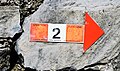
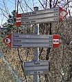
 Route markers plates help to follow the correct route
 -
 In locality Surcà, at the end of the road part of the route, we encounter the second guidepost
 -
 looking back from the track towards La Zerla
 -
 The track is always signalled by route markers
 -
 A plaque on a building invites the walkers to stop for a moment to enjoy the sight
 -
 Locality Belvedere
 -
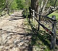
 Roccolo della Zerlaː a hut where hunters used to hide themselves to trap birds
 -
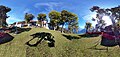
 Bocchetta La Zerla saddle (photosphere)Main category: Bocchetta della Zerla
 -
 Guideposts al La Zerla saddle
 -
 Picnic table over La Zerla saddle
 -
 The path towards Cascina Bassetta
 -
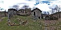
 Cascina Bassetta ruined farmhouseMain category: Cascina Bassetta
 -
_01.jpg/120px-Cascina_Bassetta_(Blessagno)_01.jpg) View from Cascina Bassetta (photosphere)
View from Cascina Bassetta (photosphere) -
 Panorama from Cascina Bassetta
 -
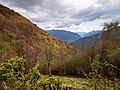
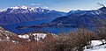
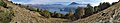
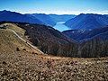 View on Como Lake from Pigra mountain crest
 -
 Cross over Alpe di ColonnoMain category: Alpe di Colonno
 -
 Small church at Alpe di Colonno
 -
 Restaurant Rifugio Alpe di ColonnoMain category: Rifugio Alpe di Colonno
 -
 Descending to Bocchetta di Colonno saddleMain category: Bocchetta di Colonno
 -
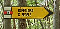
.jpg/120px-Passo_di_Boffalora_(1221).jpg) View on Boffalora saddle
View on Boffalora saddle -
.jpg/120px-Boffalora_(Ossuccio).jpg) Boffalora hamletMain category: Boffalora (Tremezzina)
Boffalora hamletMain category: Boffalora (Tremezzina) -
 Rifugio Boffalora alpine hutMain category: Rifugio Boffalora
 -
 From Passo di Boffalora the route continues upwards along the roadMain category: Passo di Boffalora
 -
 Boffalora saddle (photosphere)
 -
 Road from Passo di Boffalora in direction Alpe di Colonno
 -
 Cappella degli AlpiniMain category: Cappella degli Alpini (Boffalora)
 -
 Information board on Linea Cadorna WWI fortifications on Monte Galbiga
 -
 Pra Grassa
 -
 Pra Grassa (photosphere)
 -
 In Prà Grassa the route leaves the road and enters the grass
 -
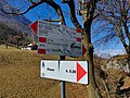
 Guidepost to the next destinationː Piazza
 -
 The route markers helps to find the way through the grass
 -
 The route enters the wood
 -
 In the wood the path is clearly marked
 -
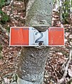 Route marker on an overgrown tree
 -
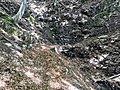
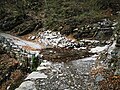
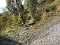
 Waterway crossing between Pra Grassa and Pioda
 -
 View on Como Lake, from the path between Pra Grassa and Pioda
 -

-
 In locality Pioda, a path branches off on the right towards San Benedetto
 -
 Guidepost in Pioda
 -
 Waterway crossing I between Pioda and Alpe Gada
 -
 Waterway crossing II between Pioda and Alpe Gada (direction forward)
 -
 Waterway crossing II between Pioda and Alpe Gada (direction backward)
 -
 Waterway crossing III between Pioda and Alpe Gada (direction forward)
 -
.jpg/120px-Attraversamento_III_tra_Pioda_e_Alpe_Gada_(Fotosfera).jpg) Waterway crossing III between Pioda and Alpe Gada (photosphere)
Waterway crossing III between Pioda and Alpe Gada (photosphere) -
 Waterway crossing III between Pioda and Alpe Gada (direction backward)
 -
 Waterway crossing IV between Pioda and Alpe Gada
 -
 Waterway crossing V between Pioda and Alpe Gada (direction forward)
 -
 Waterway crossing V between Pioda and Alpe Gada (direction backward)
 -
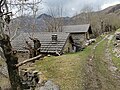
 Rural building between Alpe Chimbia and Alpe Gada
 -
 Guidepost approaching the branching of the path towards Alpe di Lenno
 -
.jpg/120px-Segnavia_al_Bivio_tra_VML2_e_sentiero_per_Alpe_di_Lenno_(2).jpg) Guidepost at the branching of the path towards Alpe di Lenno
Guidepost at the branching of the path towards Alpe di Lenno -
 Looking back at the branching of the path towards Alpe di Lenno
 -
.jpg/120px-Segnavia_al_Bivio_tra_VML2_e_sentiero_per_Alpe_di_Lenno_(3).jpg) Guidepost leaving the branching of the path towards Alpe di Lenno
Guidepost leaving the branching of the path towards Alpe di Lenno -
 Waterway crossing VI (easy) between Pioda and Alpe Gada (direction forward)
 -

-
 Waterway crossing VI (easy) between Pioda and Alpe Gada (direction backward)
 -
 Waterway crossing VII between Pioda and Alpe Gada (direction forward)
 -
 Waterway crossing VII between Pioda and Alpe Gada (direction backward)
 -
 Ruined building at Alpe Gada
 -
.jpg/120px-Attraversamento_tra_Alpe_Gada_e_Piazza_(vista_in_avanti).jpg) Waterway crossing between Alpe Gada and Piazza (direction forward)
Waterway crossing between Alpe Gada and Piazza (direction forward) -
.jpg/120px-Attraversamento_tra_Alpe_Gada_e_Piazza_(vista_all%27indietro).jpg) Waterway crossing between Alpe Gada and Piazza (direction backward)
Waterway crossing between Alpe Gada and Piazza (direction backward) -
 Entering Piazza coming from Boffalora
 -
_7.jpg/120px-Piazza_(Tremezzina)_7.jpg) Last buildings of Piazza in direction towards Boffalora
Last buildings of Piazza in direction towards Boffalora -
.jpg/120px-Photospere_in_Piazza_(Tremezzina).jpg) panoramic of Piazza (photosphere)
panoramic of Piazza (photosphere) -
_20.jpg/120px-Piazza_(Tremezzina)_20.jpg) Piazza
Piazza -
_12.jpg/120px-Piazza_(Tremezzina)_12.jpg) Guidepost in Piazza
Guidepost in Piazza -
_11.jpg/84px-Piazza_(Tremezzina)_11.jpg) Wayside shrine dedicated to San Rocco
Wayside shrine dedicated to San Rocco -
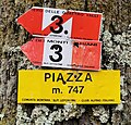
_10.jpg/120px-Piazza_(Tremezzina)_10.jpg) The place name sign confirms that you're in PiazzaMain category: Piazza (Tremezzina)
The place name sign confirms that you're in PiazzaMain category: Piazza (Tremezzina) -
_17.jpg/120px-Piazza_(Tremezzina)_17.jpg) Entering Piazza coming from Narro
Entering Piazza coming from Narro -
_14.jpg/120px-Piazza_(Tremezzina)_14.jpg) Building in Piazza Alta
Building in Piazza Alta -
 Arrival at Cascina della Croce coming from Piazza
 -
 View on Como Lake from Cascina della Croce
 -
 Arrival at Cascina della Croce coming from Garbagno
 -
 Crossing of a stream on the way from Garbagno towards Piazza
 -
 Overgrown guidepost and route marker in Garbagno
 -
 Buildings in Garbagno, along the track towards Piazza
 -
 Wayside shrine on a building of Garbagno
 -
 Photosphere in Garbagno, near a guidepost
 -
 Guidepost in GarbagnoMain category: Garbagno
 -
 The track from Piazza towards Narro intersects Torrente Val Perlana stream
 -
 A Guidepost points to a path connecting the track to San Benedetto AbbeyMain category: San Benedetto (Ossuccio)
 -
 Junction with a path towards San Benedetto Abbey (photosphere)
 -
 Looking the direction towards Piazza, a side path departs on the left, towards San Benedetto Abbey
 -
 Drinking water available at Sorgente Cumulo spring
 -
 Approaching Sorgente Cumulo spring and fountain (on the right), on the way towards Piazza
 -
 Coming from Piazza, here the route turns left towards Narro
 -
 At this junction, coming from Piazza the route takes a left turn towards Narro (photosphere)
 -
 Guidepost at a junctionː the main track from Piazza descends towards Daiè, while the route continues on a minor towards Narro
 -
 Route marker along the track from Narro to Piazza
 -
 Rural building along the track from Narro to Piazza
 -
 Buildings along the track from Narro to Piazza
 -
 The track from Piazza ends on the road in Narro
 -
 From the road in Narro begins the track towards Piazza
 -
 Guidepost in Narro, at the junction with the road climbing from Lenno
 -
 Junction in Narro, where the track from Piazza joins with the road climbing from Lenno (photosphere)
 -
 View of the road which from the upper part of Narro descends towards the crossing with the track from Piazza.
 -
 The place name sign confirms that you're in NarroMain category: Narro
 -
 The route climbs towards the upper part of Narro (photosphere)
 -
 View on Como Lake from the upper part of Narro
 -
 The place name sign confirms that you're in Narro and along the route
 -
 At the end of Narro, the trail turns right towards Ossino (photosphere)
 -
 In Narro, the trail takes a signalized right turn towards Ossino
 -
 Beginning in Narro of the mountain path towards Ossino
 -
 The narrow path towards Ossino
 -
 Towards Ossino, following the route markers
 -
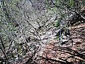
 The path towards Ossino exhibits lack of mainteinance
 -
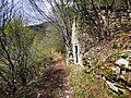
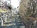
 The path towards Ossino is often lined with dilapidated dry stone walls
 -
 View of the path, in the direction towards Narro
 -
 The path towards Ossino can be rather narrow
 -
 Approaching the crossing of Torrente Pola stream, coming from Narro
 -
 Crossing of Torrente Pola stream (photosphere)
 -
 Near the crossing of Torrente Pola stream, this guidepost points to the forwarda and backwards directions of Via dei Monti Lariani
 -
 Approaching the crossing of Torrente Pola stream, coming from Ossino
 -
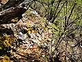
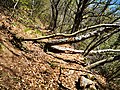 Fallen trees on the path to Ossino
 -
 The path towards Ossino passes under the cable of an abondoned ropeway
 -
 Approaching Sasso di Plazo coming from Narro
 -
 Crossing ad Sasso di Plazo (photosphere)
 -
 Guidepost near the ruined building of Sasso di Plazo
 -
 Approaching Sasso di Plazo coming from Ossino
 -
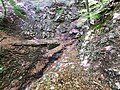
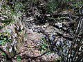
 Passage over a slab, along the path towards Ossino
 -
 Steep passage, in the direction towards Narro, just after crossing Quaglio Grande stream
 -
 Exposed passage, in the direction of Narro, exiting the crossin of Quaglio Grande stream
 -
 Crossing of Quaglio Grande waterway (photosphere)
 -
 Crossing of Quaglio Grande waterway, as seen in the directon towards Narro
 -
 Dilapidated building aside the path, in locality Trecogna
 -
 Dilapidated building aside the path, in locality Trecogna, seen as coming from Ossino
 -
 Crossing of a waterway between Trecogna and Ossino (photosphere)
 -
 Panoramic view of the a waterway crossing between Ossino and Trecogna, seen in the direction toward Narro
 -
 Panoramic view of Como Lake from Ossino
 -
 Looking back at the path in direction of Narro
 -
 Panoramic view of Monti di Ossino (photosphere)
 -
 Rural building in Ossino
 -
 The route crossed a patch of grass, highlighted by route markers
 -
 Beginning of path from Ossino towards Narro
 -
 Coming from Narro, the path ends on the road coming up from Mezzegra towards Ossino
 -
 Crossing where the path from Narro intersects the road connecting Mezzegra to Ossino (photosphere)
 -
 Guidepost in Ossino
 -
 Via dei Monti Lariani coming from Narro continues upwards along the road
 -
 The beginning of the path to Narro, as seen coming from Ossino
 -
 The route follows the road upwards to Ossino for a few meters
 -
 The route in the direction towards Narro, descends for a few meters along the road which descends toward Mezzegra
 -
 Panoramic view of Como Lake from the road in Ossino
 -
 Rural building in Ossino along the road at Ossino
 -
 Name sign MONTI DI OSSINO affixed to the buildingMain category: Ossino
 -
 Crossing where the route leaves the road and takes a path towards Galleria del Tremezzo tunnel (photosphere)
 -
 Looking back towards Narro, at the beginning of the stretch of road in Ossino used by the route
 -
 Beginning of the path from Ossino towards Galleria del Tremezzo tunnel
 -
 the buildings of Ossino start to appear (arriving from Galleria del Tremezzo)
 -
 Initially the path from Ossino towards Galleria del Tremezzo is well visible
 -
 Towards Ossino, traversing a steep slope
 -
 Towards Ossino, traversing a steep slope
 -
 approaching Valle Bolvedro
 -
 Crossing of Valle del Costone
 -
 passing between ruins of Casera del Costone
 -
 ruins of Casera del Costone, as seen going towards Ossino
 -
 towards the crossing of Torrente Bolvedro
 -
 looking down from the crossing of Torrente Bolvedro
 -
 the last steep climb, to reach the intersection with the military road (guideposted)
 -
 Guidepost at the junction with the ex military road to Monte di Tremezzo, directions towards Grandola ed Uniti
 -
 Guidepost at the junction with the ex military road to Monte di Tremezzo, directions towards San Fedele
 -
 Tunnel of Monte Tremezzo, southern end (photosphere)
 -
 Tunnel of Monte Tremezzo, northern endMain category: Galleria del Tremezzo
 -
 Board with historical information about the military road
 -
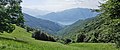
 Panorama on Como Lake from the military road
 -
.jpg/120px-Monte_Brent_(Tremezzina).jpg) Locality Monte Brent (photosphere)Main category: Monte Brent
Locality Monte Brent (photosphere)Main category: Monte Brent -
 A building below Monte Brent
 -
 A sideway fountain
 -
 Guidepost between Monti di Nava and Monte Brent
 -
 Crossing with the link from Griante, at Monti di Nava (photosphere)
 -
.jpg/120px-Segnavia_ai_Monti_di_Nava_(1-2).jpg) Guidepost at Monti di Nava
Guidepost at Monti di Nava -
.jpg/120px-Segnavia_ai_Monti_di_Nava_(2-2).jpg) Guidepost at Monti di Nava, pointing to the route access link from Griante
Guidepost at Monti di Nava, pointing to the route access link from Griante -
 Buildings at Monti di Nava (photosphere)Main category: Monti di Nava
 -
.jpg/120px-Bocchetta_di_Nava_(foto_panoramica_sferica).jpg) Saddle Bocchetta di Nava (photosphere)Main category: Bocchetta di Nava
Saddle Bocchetta di Nava (photosphere)Main category: Bocchetta di Nava -
 Guidepost at Bocchetta di Nava saddle
 -
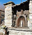
 Wayside shrine at Bocchetta di Nava saddle
 -
 Faded name sign at Monti di Nava
 -
 Photosphere at Mie
 -
 Place name Mie
 -
 Church Madonna di PaulloMain category: Madonna di Paullo
 -
 Guidepost in Paullo
 -
 Lavoir in Croce di Menaggio
 -
 Guidepost in Croce di Menaggio
 -
 Monte Crocione in the background of the building in Croce di Menaggio
 -
 Croce di Menaggio (photospere)
 -
.jpg/120px-Chiesa_dei_Santi_Pietro_e_Paolo_(Croce_di_Menaggio).jpg) Chiesa dei Santi Pietro e Paolo church in Croce
Chiesa dei Santi Pietro e Paolo church in Croce -
 Guidepost in Cardano
 -
.jpg/120px-Inizio_VML2_a_Cardano_(Grandola_ed_Uniti).jpg) Beginning of section 2 of the route, in Cardano
Beginning of section 2 of the route, in Cardano

.jpg)


.jpg)


_01.jpg)


.jpg)
.jpg)


.jpg)


.jpg)

.jpg)


.jpg)
.jpg)

_7.jpg)
.jpg)
_20.jpg)
_12.jpg)
_11.jpg)
_10.jpg)
_17.jpg)
_14.jpg)


.jpg)


.jpg)
.jpg)

.jpg)


.jpg)

.jpg)
Section 3
[edit]Main category: Via dei Monti Lariani - sezione 3
-
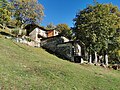
 Beginning of section 3 of the route, in CardanoMain category: Cardano (Grandola ed Uniti)
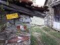
 -
Guidepost in Cardano
-
 Lavoir in CardanoMain category: Lavoir of Cardano
 -
.jpg/118px-Segnavia_a_Cardano%2C_via_Carlo_Galbiati_(1-2).jpg) Guidepost in Cardano (photo 1)
Guidepost in Cardano (photo 1) -
.jpg/108px-Segnavia_a_Cardano%2C_via_Carlo_Galbiati_(2-2).jpg) Guidepost in Cardano (photo 2)
Guidepost in Cardano (photo 2) -
 Church of CardanoMain category: Santi Caterina, Bernardo e Francesco Saverio
 -
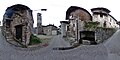
 Approaching Villa Camozzi in CodognaMain category: Codogna
 -
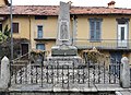
 War memorial in Codogna
 -
._02.jpg/92px-Segnavia_Codogna_piazza_Camozzi_(2-2)._02.jpg) Guidepost in Codogna
Guidepost in Codogna -
.jpg/120px-Villa_Camozzi_in_Codogna_(Grandola_ed_Uniti).jpg) Villa Camozzi, in CodognaMain category: Villa Camozzi (Codogna)
Villa Camozzi, in CodognaMain category: Villa Camozzi (Codogna) -
 Former nailary (currently a restaurant and trout breeding ) Mulino ChioderiaMain category: Mulino Chioderia
 -
.jpg/120px-Segnavia_Mulino_Chioderia_(1-2).jpg) Guidepost at Mulino Chioderia
Guidepost at Mulino Chioderia -
 Information board about Mulino Chioderia
 -
 Trout breeding at Mulino Chioderia (photosphere)
 -
.jpg/120px-Segnavia_per_Barna_(1-2).jpg) Guidepost at the back of Mulino Chioderia
Guidepost at the back of Mulino Chioderia -
 Glacial erratic, named "La Pendula", along the mule path to Barna
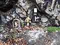
 -
 A wayside shrine along the path to Barna
 -
 Arrival in BarnaMain category: Barna (Plesio)
 -
.jpg/120px-Dipinto_su_facciata_di_edificio_(Barna%2C_Plesio).jpg) Painting on the wall of a building in Barna
Painting on the wall of a building in Barna -
.jpg/120px-Fotosfera_a_Piazza_del_Tavolo_(Barna).jpg) Piazza del Tavolo, Barna (photosphere)
Piazza del Tavolo, Barna (photosphere) -
 Guidepost in Piazza del Tavolo square in Barna
 -
.jpg/114px-Uscita_da_Piazza_del_Tavolo_(Barna).jpg) Leaving Piazza del Tavolo towards Piazza della Chiesa
Leaving Piazza del Tavolo towards Piazza della Chiesa -
.jpg/120px-Guidepost_in_Piazza_del_Tavolo_(Barna).jpg) Guidepost at the exit of Piazza del Tavolo square in Barna
Guidepost at the exit of Piazza del Tavolo square in Barna -
.jpg/120px-Piazza_della_Chiesa_a_Barna_(fotosfera).jpg) Piazza della Chiesa square in Barna (photosphere)
Piazza della Chiesa square in Barna (photosphere) -
 War memorial in BarnaMain category: Monumento ai Caduti (Barna)
 -
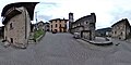
 Piazza della Chiesa square
 -
 Fountain in BarnaMain category: Fontana di Barna
 -
 Guidepost in Piazza della Chiesa in Barna
 -
.jpg/120px-Piazza_della_Chiesa_a_Barna%2C_dal_lato_nord_(fotosfera).jpg) Northern side of Piazza della Chiesa (photosphere)
Northern side of Piazza della Chiesa (photosphere) -
.jpg/94px-Facciata_di_Santa_Maria_Maddalena_(Plesio).jpg) Chiesa di Santa Maria Maddalena churchMain category: Santa Maria Maddalena (Plesio)
Chiesa di Santa Maria Maddalena churchMain category: Santa Maria Maddalena (Plesio) -
 The route continues along the right side of the church (photosphere)
 -
.jpg/90px-Via_del_Pozzo_Bernasco_(Barna%2C_Plesio).jpg) Via del Pozzo Bernasco (Barna)
Via del Pozzo Bernasco (Barna) -
 Straight, towards Breglia
 -
 Old fountain along the route
 -
 Fallen trees on the path between Barna and La Piazza, easy to circumvent
 -
 The path ends on a track towards La Piazza
 -
 Looking back at the path from Barna
 -
 Picnic site in locality Pianca della Rana, operated by Alpini (alpin troops veterans)
 -
.jpg/120px-Area_picnic_vicino_a_La_Piazza_(fotosfera).jpg) Photosphere of the picnic site, here partially dismantled
Photosphere of the picnic site, here partially dismantled -
 Arrival in locality La Piazza
 -
 Guidepost in La Piazza, where the route Via dei Monti Lariani meets the route Sentiero delle Quattro ValliMain category: Sentiero delle Quattro Valli
 -
.jpg/120px-Capela_del_Bergum_(La_Piazza%2C_Plesio).jpg) Chapel in La PiazzaMain category: Capela del Bergum
Chapel in La PiazzaMain category: Capela del Bergum -
_-_fotosfera.jpg/120px-Località_La_Piazza_(Plesio)_-_fotosfera.jpg) Photosphere in La Piazza
Photosphere in La Piazza -
 Place name Piazza (alternative for La Piazza)Main category: La Piazza
 -

-
 Map in La Piazza
 -
 Guidepost with directions towards Breglia, in La Piazza
 -
 Drinking fountain in La Piazza
 -
 Short cut on the left, on path towards Prato Stella
 -
 View on Como Lake from Prato Stella
 -
 From Prato Stella towards Breglia
 -
 Towards Breglia
 -
 Panoramic view from Barì. At center, the sanctuary over Breglia
 -
_02.jpg/120px-Guidepost_in_Barì_(Plesio)_02.jpg) Guidepost in Barì
Guidepost in Barì -
.jpg/120px-Lavatoio_a_Barì_(Plesio).jpg) Lavoir with water tap, along the descent towards Breglia
Lavoir with water tap, along the descent towards Breglia -
%2C_al_bivio_tra_Breglia_e_Mulino_Spinzi.jpg/120px-Guidepost_in_Barì_(Plesio)%2C_al_bivio_tra_Breglia_e_Mulino_Spinzi.jpg) Guidepost in Barì
Guidepost in Barì -

-

-
 Via dei Monti Lariani shares the route with Sentiero delle Quattro Valli
 -

-
-

-
-
.jpg/120px-Arrivo_a_Maggino_(nucleo_abitato_occidentale_di_Breglia).jpg) arrival to Maggino
arrival to Maggino -
.jpg/120px-Inizio_di_Via_al_Tröi_(Maggino).jpg) Via al Tröi in Maggino
Via al Tröi in Maggino -
.jpg/109px-Via_al_Tröi_(Breglia).jpg)
-

-
.jpg/120px-Bivio_Via_al_Tröi_-_Via_della_Piazza_(Peglio).jpg)
-
.jpg/120px-Fontanella_in_Via_della_Piazza_(Breglia).jpg) drinking water in Maggino
drinking water in Maggino -
.jpg/120px-Fotosfera_Via_della_Piazza_(Breglia).jpg) photosphere in Maggino
photosphere in Maggino -
.jpg/120px-Bivio_Via_della_Piazza_-_Via_Gera_(Breglia).jpg)
-
.jpg/120px-Via_Breglia_(Maggino).jpg) Via Gera, with route marker on the wall on the right
Via Gera, with route marker on the wall on the right -
.jpg/120px-Fontanella_a_Maggino_(Breglia).jpg) drinking water at the end of Maggino
drinking water at the end of Maggino -
 Hotel Albergo Breglia, along the route
 -
.jpg/120px-Entering_Villa_in_Breglia_(Plesio).jpg) Entering Villa
Entering Villa -
_seen_from_VML3.jpg/120px-San_Gregorio_(Breglia)_seen_from_VML3.jpg) Church of San Gregorio in BregliaMain category: San Gregorio (Breglia, Plesio)
Church of San Gregorio in BregliaMain category: San Gregorio (Breglia, Plesio) -
 narrow street in Villa
 -

-
.jpg/116px-Drinking_water_and_firehydrant_in_Vai_Gera_(Plesio).jpg)
-

-
.jpg/120px-Wayside_shrine_in_Via_Gera_(Plesio).jpg)
-
.jpg/86px-Interior_of_wayside_shrine_in_Via_Gera_(Plesio).jpg)
-

-

-

-
 arrival at Rifugio La Preda, from Breglia (photosphere)
 -
 Rifugio La Preda
 -
 Rifugio La Preda
 -
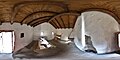 Photosphere of Interior of Rifugio La Preda
 -
 intersection near stream Torrente Serio
 -

-

-
 photosphere from bridge over stream Torrente Serio
 -

-
.jpg/120px-Picnic_site_by_wayside_shrine_La_Madonna_della_Valle_(San_Siro).jpg)
-
.jpg/120px-Wayside_shrine_La_Madonna_della_Valle_(San_Siro).jpg) La Madonna della Valle
La Madonna della Valle -
 arrival in Carcente (from Breglia)
 -
-

-
 Fountain in Carcente
 -
 photosphere in Carcente
 -
.jpg/120px-Street_name_Via_per_Breglia_(Carcente).jpg) Via per Breglia, on the right optional detour to museum in Carcente
Via per Breglia, on the right optional detour to museum in Carcente -
 photosphere
 -
 Via Carcente
 -
.jpg/120px-Street_sign_Via_Carcente_(San_Siro).jpg)
-
 photosphere
 -
 Via alla Mason dei Monti
 -
.jpg/120px-View_from_Piazza_di_Prott_(San_Siro).jpg)
-
.jpg/120px-Piazza_di_Prott_(San_Siro).jpg)
-
.jpg/120px-View_on_Como_Lake_from_Carcente_(wide).jpg) Panoramic view on Carcente and Como Lake, from the path to Monti di Carcente
Panoramic view on Carcente and Como Lake, from the path to Monti di Carcente -

-

-

-

-

-
 Monti di Carcente
 -

-

-
 path towards Alpe Rescanscia
 -
 path towards Sant'Amate
 -

-

-
 photosphere in Monti di Treccione
 -
 photosphere in Monti di Treccione
 -
 Monti di Treccione
 -

-

-

-
 photosphere in Monti di Treccione
 -
-

-

-

-

-

-
 Pian del Lac
 -
-
 the route leaves the road and heads to Montuglio
 -
 Fountain in Montuglio
 -
 Parking place in Montuglio
 -
-
 Guidepost in Montuglio
 -
 Leaving Montuglio towards Monti Luina
 -

-

-
 photosphere at crossingo with path towards Luina
 -

-
 Monti di Giugallo
 -

-
-
-

-

-

-

-
 photosphere at ford in Vallone Cremia
 -
 Monti Luina
 -

-

-

-

-
 track towards Monti Luina
 -

-
-

-
 photosphere at Monti di Bracco
 -

-

-
 name plate BRACCO
 -

-
 Monti di Bracco
 -

-

-

-

-
-
-

-
-

-
-
-
.jpg/120px-Photosphere_by_San_Domenico_(Cremia).jpg) photosphere at San Domenico
photosphere at San Domenico -
_02.jpg/120px-San_Domenico_(Cremia)_02.jpg) Church of San DomenicoMain category: San Domenico (Cremia)
Church of San DomenicoMain category: San Domenico (Cremia) -
_02.jpg/120px-Panoramic_view_from_San_Domenico_(Cremia)_02.jpg) panoramic viwe from San Domenico
panoramic viwe from San Domenico -
 leaving San Domenico towards Piazzucco
 -

-
-

-
 Fountain in Piazzucco
 -

-
-
 photosphere in Piazzucco
 -
-
 photosphere in Piazzucco
 -
 route marker in Piazzucco
 -
 route marker north of Piazzucco
 -
-
.jpg/120px-Assisted_trail_between_Piazzucco_and_Naro_(2).jpg)
-
 Val Beller valley
 -

-
.jpg/120px-VML3_between_Val_Beller_and_Monti_di_Naro_(2).jpg)
-
.jpg/120px-Guidepost_on_VML3_between_Val_Beller_and_Monti_di_Naro_(2).jpg)
-
.jpg/120px-VML3_between_Val_Beller_and_Monti_di_Naro_(3).jpg)
-

-
.jpg/120px-Guidepost_on_VML3_between_Val_Beller_and_Monti_di_Naro_(3).jpg)
-
-
-
-
-
 Photosphere at Monti di Naro
 -
 Fountain at Monti di Naro
 -
 Naro
Naro -

-
 Panoramic view from Monti di Naro
 -

-

-
 Panoramic view from Alpe di Nalcim
 -
 Photosphere at Alpe di Nalcim
 -
 Fountain at Alpe di Nalcim
 -

-
 Photosphere at Alpe di Nalcim
 -
 Alpe di Nalcim
 -

-
.jpg/120px-Name_sign_and_route_marker_at_Alpe_di_Nalcim_(side_north).jpg)
-

-

-

-

-
-

-
 Monti Dacca
 -
 Photosphere at Monti Dacca
 -
 Brecchio
 -
 view from Brecchio
 -
 Photosphere in Brecchio
 -

-

-
 Photosphere between Brecchio and Labbio
 -

-

-

-

-

-

-

-

-
 Photosphere approaching San Bernardo
 -
 San BernardoMain category: San Bernardo (Dongo)
 -
.jpg/120px-Photosphere_in_front_of_San_Bernardo_(Dongo).jpg) Photosphere in front of San Bernardo
Photosphere in front of San Bernardo -
 Panoramic view from San Bernardo, Lake Como, Monte Legnone
 -
.jpg/120px-Panoramic_view_on_church_San_Bernardo_Dongo).jpg) View from picnic site at San Bernardo
View from picnic site at San Bernardo -

-
 Photosphere at Bocchetta di San Bernardo
 -

-
-
-
 View on Valle Albano from Bocchetta di San Bernardo
 -
 Panoramic view on Valle Albano
 -

-

-
 turn down towards Piazze
 -

-
_along_VML3.jpg/120px-Fountain_in_Monte_Piazze_(Garzeno)_along_VML3.jpg) Fountain in Monte Piazze
Fountain in Monte Piazze -
 Monte Piazze
 -

-

-

-
 Fountain in Mutadello
 -
.jpg/120px-Name_sign_Mutadello_(Garzeno).jpg) name sign Mutadello
name sign Mutadello -
 entering Mutadello in direction San Bernardo
 -
 track towards Mutadello
 -
 intersection with forest road to Cremesino
 -
.jpg/97px-Wayside_shrine_in_Guaggio_di_Sotto_(Garzeno).jpg) Wayside shrine in Guaggio di Sotto
Wayside shrine in Guaggio di Sotto -
_01.jpg/120px-Photosphere_on_Piazza_della_Chiesa_(Garzeno)_01.jpg) section 3 ends in Garzeno
section 3 ends in Garzeno


.jpg)
.jpg)


._02.jpg)
.jpg)

.jpg)


.jpg)


.jpg)
.jpg)

.jpg)
.jpg)


.jpg)
.jpg)

.jpg)


.jpg)


.jpg)
_-_fotosfera.jpg)


_02.jpg)
.jpg)
,_al_bivio_tra_Breglia_e_Mulino_Spinzi.jpg)


.jpg)
.jpg)
.jpg)

.jpg)
.jpg)
.jpg)
.jpg)
.jpg)
.jpg)

.jpg)
_seen_from_VML3.jpg)


.jpg)

.jpg)
.jpg)


.jpg)
.jpg)


.jpg)


.jpg)


.jpg)
.jpg)
.jpg)


.jpg)
_02.jpg)


.jpg)


.jpg)
.jpg)
.jpg)

.jpg)


.jpg)


.jpg)


_along_VML3.jpg)


.jpg)


.jpg)
_01.jpg)
Section 4
[edit]Main category: Via dei Monti Lariani - sezione 4
-
.jpg/120px-Map_of_Via_dei_Monti_Lariani%2C_in_Piazza_della_Chiesa_(Garzeno).jpg)
-
_03.jpg/120px-Photosphere_on_Piazza_della_Chiesa_(Garzeno)_03.jpg) section 4 starts in Garzeno
section 4 starts in Garzeno -
.jpg/85px-Church_Santi_Pietro_e_Paolo_(Garzeno).jpg) Church Santi Pietro e Paolo (Garzeno)
Church Santi Pietro e Paolo (Garzeno) -
.jpg/120px-Street_corner_of_Via_Sopra_Pozzi_and_Via_Sant%27Anna_(Garzeno).jpg)
-

-
-

-

-
-

-
-

-

-
.jpg/120px-Waterworks_building_above_Garzeno_(2).jpg)
-

-
_01.jpg/120px-Photosphere_in_L%27Avolo_(Gravedona_ed_Uniti)_01.jpg) approaching L'Avolo
approaching L'Avolo -
 arrival in L'Avolo
 -
-
_02.jpg/120px-Photosphere_in_L%27Avolo_(Gravedona_ed_Uniti)_02.jpg)
-
_and_fountain_in_L%27Avolo.jpg/120px-Masun_(rural_building)_and_fountain_in_L%27Avolo.jpg) Masun (typicol local type of rural building) and fountain in L'Avolo
Masun (typicol local type of rural building) and fountain in L'Avolo -
.jpg/89px-Wayside_shrine_in_L%27Avolo_(2).jpg)
-

-
_06.jpg/120px-Photosphere_in_L%27Avolo_(Gravedona_ed_Uniti)_06.jpg)
-
 locality Combè
 -
 crossing Lake Como Adventure Park
 -

-

-
%2C_along_VML4%2C_just_before_passing_aside_the_chruch.jpg/120px-Photosphere_in_Sant%27Anna_(Germasino)%2C_along_VML4%2C_just_before_passing_aside_the_chruch.jpg)
-
.jpg/120px-Fountain_by_church_Sant%27Anna_(Gravedona_ed_Uniti).jpg) Fountain in Sant'Anna
Fountain in Sant'Anna -
.jpg/120px-Church_Sant%27Anna_(Gravedona_ed_Uniti).jpg) Church Sant'Anna, in locality Sant'Anna di Germasino
Church Sant'Anna, in locality Sant'Anna di Germasino -
%2C_where_VML4_hits_the_road_01.jpg/120px-Photosphere_in_Sant%27Anna_(Germasino)%2C_where_VML4_hits_the_road_01.jpg)
-
_01.jpg/120px-Buildings_in_Sant%27Anna_di_Germasino_(Gravedona_ed_Uniti)_01.jpg)
-
_02.jpg/120px-Buildings_in_Sant%27Anna_di_Germasino_(Gravedona_ed_Uniti)_02.jpg)
-

-

-
 Cagnavo
 -

-

-

-

-

-

-
-
-
 Cragno
 -

-

-
 Stabiè
 -

-
.jpg/120px-Photosphere_along_VML4%2C_among_the_buildings_of_Monte_Stabiè_(2).jpg)
-

-

-

-

-
 Iévia
Iévia -
 Iévia
Iévia -

-

-

-

-

-
 Sciee
Sciee -

-

-
%2C_along_VML4.jpg/120px-Crossing_at_Nessa_(Stazzona)%2C_along_VML4.jpg) Nessa
Nessa -
.jpg/101px-Information_board_on_VML_in_Nessa_(Stazzona).jpg)
-
-
_%2C_along_VML4.jpg/120px-Track_in_Nessa_(Stazzona)_%2C_along_VML4.jpg)
-
.jpg/120px-Route_marker_on_a_fence_in_Nessa_(Stazzona).jpg)
-
_along_VML4.jpg/120px-Photosphere_in_Nessa_(Stazzona)_along_VML4.jpg)
-
 ford
ford -

-

-

-
 ford
ford -
 intersection
 -

-

-
 intersection
 -

-
 Madonna del Sasso Rondolino
 -

-
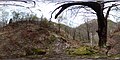
_01.jpg/120px-Photosphere_in_L%27Agnone_(Stazzona)_01.jpg)
-
%2C_towards_Badalucco.jpg/120px-Arriving_in_L%27Agnone_(Stazzona)%2C_towards_Badalucco.jpg)
-
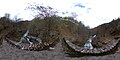
_02.jpg/120px-Photosphere_in_L%27Agnone_(Stazzona)_02.jpg)
-
.jpg/120px-Building_in_L%27Agnone_(Stazzona).jpg)
-
 L'Agnone
 -
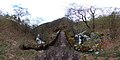
_03.jpg/120px-Photosphere_in_L%27Agnone_(Stazzona)_03.jpg)
-
_%2C_VML4_in_direction_of_Nessa.jpg/120px-L%27Agnone_(Stazzona)_%2C_VML4_in_direction_of_Nessa.jpg)
-
.jpg/120px-Panoramic_view_from_L%27Agnone_(Stazzona).jpg)
-
_04.jpg/120px-Photosphere_in_L%27Agnone_(Stazzona)_04.jpg)
-
%2C_direction_towards_Nessa.jpg/120px-VML4_in_L%27Agnone_(Stazzona)%2C_direction_towards_Nessa.jpg)
-
_05.jpg/120px-Photosphere_in_L%27Agnone_(Stazzona)_05.jpg)
-
_06.jpg/120px-Photosphere_in_L%27Agnone_(Stazzona)_06.jpg)
-
_07.jpg/120px-Photosphere_in_L%27Agnone_(Stazzona)_07.jpg)
-

-

-

-

-

-

-
_01.jpg/120px-Photosphere_in_Badalucco_(Gravedona_ed_Uniti)_01.jpg)
-
.jpg/120px-Place_name_sign_Badalucco_(Gravedona_ed_Uniti).jpg) Badalucco
Badalucco -
_03.jpg/120px-Photosphere_in_Badalucco_(Gravedona_ed_Uniti)_03.jpg)
-
_06.jpg/120px-Badalucco_(Gravedona_ed_Uniti)_06.jpg)
-
_04.jpg/120px-Photosphere_in_Badalucco_(Gravedona_ed_Uniti)_04.jpg)
-
_01.jpg/120px-Fountain_in_Badalucco_(Gravedona_ed_Uniti)_01.jpg)
-
_05.jpg/120px-Photosphere_in_Badalucco_(Gravedona_ed_Uniti)_05.jpg)
-
_01.jpg/120px-Badalucco_(Gravedona_ed_Uniti)_01.jpg)
-
_06.jpg/120px-Photosphere_in_Badalucco_(Gravedona_ed_Uniti)_06.jpg)
-
_08.jpg/120px-Photosphere_in_Badalucco_(Gravedona_ed_Uniti)_08.jpg)
-
_11.jpg/120px-Photosphere_in_Badalucco_(Gravedona_ed_Uniti)_11.jpg)
-
-

-

-

-

-

-

-

-
-
-

-
 bridge of Budanghel
 -

-

-

-
 Valle di Margine
 -

-
 Badongheno
 -

-
-

-

-

-
.jpg/114px-Facade_of_church_San_Giacomo_nuova_(Livo%2C_Lombardy).jpg) church San Giacomo nuova in Livo
church San Giacomo nuova in Livo -

-
-

-
.jpg/110px-Fountain_in_Livo_(Lombardy).jpg) Fountain in Livo
Fountain in Livo -
-

-

-

-

_03.jpg)
.jpg)
.jpg)


.jpg)

_01.jpg)

_02.jpg)
_and_fountain_in_L%27Avolo.jpg)
.jpg)

_06.jpg)


,_along_VML4,_just_before_passing_aside_the_chruch.jpg)
.jpg)
.jpg)
,_where_VML4_hits_the_road_01.jpg)
_01.jpg)


.jpg)


,_along_VML4.jpg)
.jpg)

_,_along_VML4.jpg)
.jpg)
_along_VML4.jpg)


_01.jpg)
_02.jpg)
.jpg)

_03.jpg)
_,_VML4_in_direction_of_Nessa.jpg)
_04.jpg)
,_direction_towards_Nessa.jpg)
_05.jpg)
_06.jpg)
_07.jpg)


_01.jpg)
.jpg)
_03.jpg)
_06.jpg)
_04.jpg)
_01.jpg)
_05.jpg)
_01.jpg)
_06.jpg)
_08.jpg)
_11.jpg)


.jpg)


.jpg)


